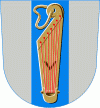
Veteli
 |
It is located in the province of Western Finland and is part of the Central Ostrobothnia region. The municipality had a population of almost 3200 in 2019. and covers an area of undefined km2 of which undefined km2 is water. The population density is undefined PD/km2.
Neighbouring municipalities are Evijärvi, Halsua, Kaustinen, Kronoby, Lappajärvi, Perho and Vimpeli.
The municipality is unilingually Finnish.
Results of the 2011 Finnish parliamentary election in Veteli:
* Centre Party 42.1%
* True Finns 39.3%
* Social Democratic Party 7.8%
* Christian Democrats 4.2%
* National Coalition Party 3.3%
Map - Veteli
Map


Country - Finland
 |
 |
| Flag of Finland | |
Finland was first inhabited around 9000 BC after the Last Glacial Period. The Stone Age introduced several different ceramic styles and cultures. The Bronze Age and Iron Age were characterized by contacts with other cultures in Fennoscandia and the Baltic region. From the late 13th century, Finland became a part of Sweden as a consequence of the Northern Crusades. In 1809, as a result of the Finnish War, Finland became part of the Russian Empire as the autonomous Grand Duchy of Finland, during which Finnish art flourished and the idea of independence began to take hold. In 1906, Finland became the first European state to grant universal suffrage, and the first in the world to give all adult citizens the right to run for public office. After the 1917 Russian Revolution, Finland declared independence from Russia. In 1918, the fledgling state was divided by the Finnish Civil War. During World War II, Finland fought the Soviet Union in the Winter War and the Continuation War, and Nazi Germany in the Lapland War. It subsequently lost parts of its territory, but maintained its independence.
Currency / Language
| ISO | Currency | Symbol | Significant figures |
|---|---|---|---|
| EUR | Euro | € | 2 |
| ISO | Language |
|---|---|
| FI | Finnish language |
| SV | Swedish language |